Thursday, January 12, 2006
I’m Watching You Mrs. Crane
As I said when I first hit puberty “I can’t stop playing with this thing.”
If you haven’t downloaded this yet, you should. It doesn’t take up much space and it’s free. Just make sure you have a high speed connection, otherwise it takes forever to view anything.
So far I have looked up every apartment I’ve ever lived in. Every place I’ve ever worked (and there’s a lot), and just about everything else you can imagine.
Here are a few examples-
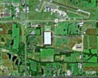
 What you see here is a view of the distribution center I work in. If it looks pretty big, well that’s ‘cause it is. It’s just over 1.3 million square feet (that’s why I have a golf cart, just like Michael Keaton in “Gung Ho). You’ll also notice how fuzzy it is. I suppose it’s either because of cloud cover on the day the picture was taken, some sort of over-my-understanding curve of the earth thingy, or that Marion just ain’t important enough to take up to much focus. I’m betting on the latter of the three.
By contrast you have this-  At about 9:00 is where my old apartment in Columbus, Oh. is (just next to Gabby’s bar, oh Gabby’s). The detail, as you can see, is much clearer. If I were to zoom in more you could make out cars and even people walking.
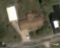
Which brings up this- Here you’ll see my in-law’s house in DuQuoin, IL. (the light colored rectangle is the built on shed / garage). It’s not far from Carbondale which comes in much clearer than Marion, probably because of Southern Illinois University. Anyway in the driveway is what I’ve positively identified as MY TRUCK.
Yep, Big Brother got me.
As much as if find that to be really cool, I also find it to be a just a little creepy.
http://maps.google.com/maps?f=q&hl=en&q=stl&t=k&ll=38.751038,-90.356541&spn=0.010007,0.026779&t=k
I haven't yet found an actual image of my vehicles yet; the imagery varies in time periods, but since I lived in my last place for 7 years, I assumed that the pictures were taken while I was in residence. But I must have been out when they took the shot.
The pictures are also updated every so often. When Google Maps first came out, I remember that the image of the Pentagon must have been taken in early 2002 because a large part of it was demolished. The image now is more recent, as it's been reconstructed.
<< Home

